
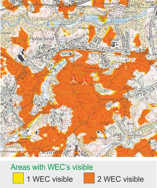
Our visibility studies find out the locations from where your
planned wind farm will be visible.
Based on digital databases, topo-graphic maps and aerial photographs,
view-obstructing elements such as trees, houses, forests, towns, etc. as well as
the orography (hills, mountains, valleys) will be taken into con-sideration.
Computer-assisted modeling allows us to map areas that have a complete or
partial view of the proposed wind farm.
Click to enlarge!

service - wind potential
wind data analysesservice - wind measurements
evaluation of wind measurementsservice - environment
shadow and noise calculationsabout AL-PRO
company presentation